
When we think of the Greber Plan, we tend to think of the bigger, more obvious things that were done to the city, such as the widening of Elgin Street or the ripping up of the railway lines out of the downtown area, or the creation of the Greenbelt. What is less well-known is Jacques Greber’s influence on what were once quieter north-south streets in the old urban core, and in particular, Metcalfe and O’Connor Streets.
In his initial 1938 surveys, Greber considered Metcalfe or O’Connor as viable alternatives to Elgin as grand boulevards. His later studies ruled them out in favour of Elgin. He states in his 1950 report: “At the commencement of our studies in 1938, we had envisioned the creation of a main artery extending southerly from Wellington Street and facing the Houses of Parliament, by utilizing and widening Metcalfe Street…a monumental street, implying from its width, a street opening rather than a widening.” However, he says this proposal was not retained because, among other things, 1. Elgin was already being widened as a traffic collector, 2. The profile of Metcalfe had to be retained and the resulting perspective was not “satisfactory”, 3. Too many monumental buildings located at the northern terminus would have to be demolished, and 4. The aesthetics of the “Gothic Victorian” Parliament Buildings would have clashed too much with the more residential style of Centretown.
But Greber didn’t have qualms about knocking down residential structures in the name of planning a better city. And he did not shy away from recommending that O’Connor and Metcalfe be turned into efficient traffic sewers in and out of downtown. This is the reason why, since the late 1950s, Metcalfe has been a one-way street heading north, and O’Connor has been one-way heading south. Since then, all official city plans designate these two streets as arterials, and as such, a once desirable residential area has become a comparative dead zone, an island marooned by waves of traffic.
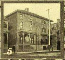
1904 image of Sir John A. MacDonald’s house. Photo from Hub and Spokes.
This month, we look at O’Connor Street from Somerset northwards. Cabinet Ministers, Prime Ministers, and high ranking business people, Ottawa mayors, and members of parliament chose to live along or near this street. In the 1904 book the Hub and Spokes, author Anson Gard called O’Connor “beautiful”, and mentions that Sir. John A. MacDonald even lived here! Yes, it turns out our first Prime Minister lived in a house now long gone just northwest of the intersection of O’Connor and Laurier (see image above) sometime during the early 1870s!
Today, if you walk north from Somerset, you will find a quick transition from low rise residential to mid-century apartment blocks to modern high rise office buildings. Compare how the street looked in 1938, and you will note that the only landmarks still visible are Dominion Chalmers Church and the Bell Telephone Company Building.
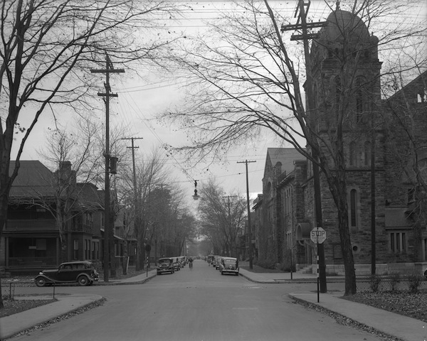
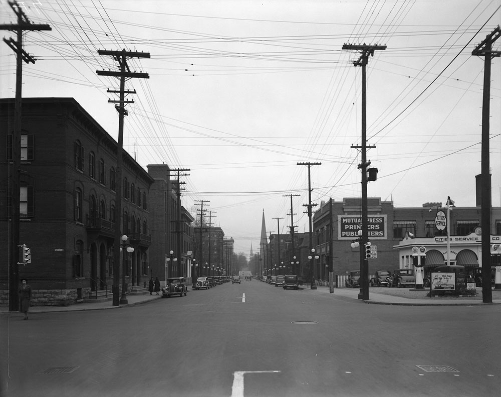
The church is an aesthetically pleasing ecclesiastical structure designed by the prolific Montreal-based architect Alexander Hutchinson. Built at the intersection of Cooper and O’Connor in 1912-14 for an extraordinary sum of $105,000, the church is a massive, low-rise structure constructed in the Romanesque architectural style with colourful Nepean sandstone. One of the defining features is the square corner tower with rounded roof, another is its short rounded tower. The church turns up in a number of the images of O’Connor in 1938 (see images at Cooper Street above and looking south from Lisgar), and you’ll note how well it blended into the surrounding low-rise residential streetscape. While the streetscape has drastically changed, the church endures and is a dominant and pleasing visual presence.
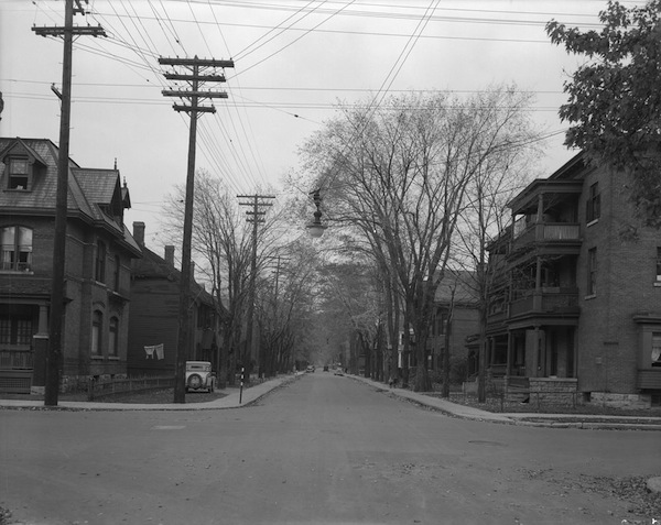
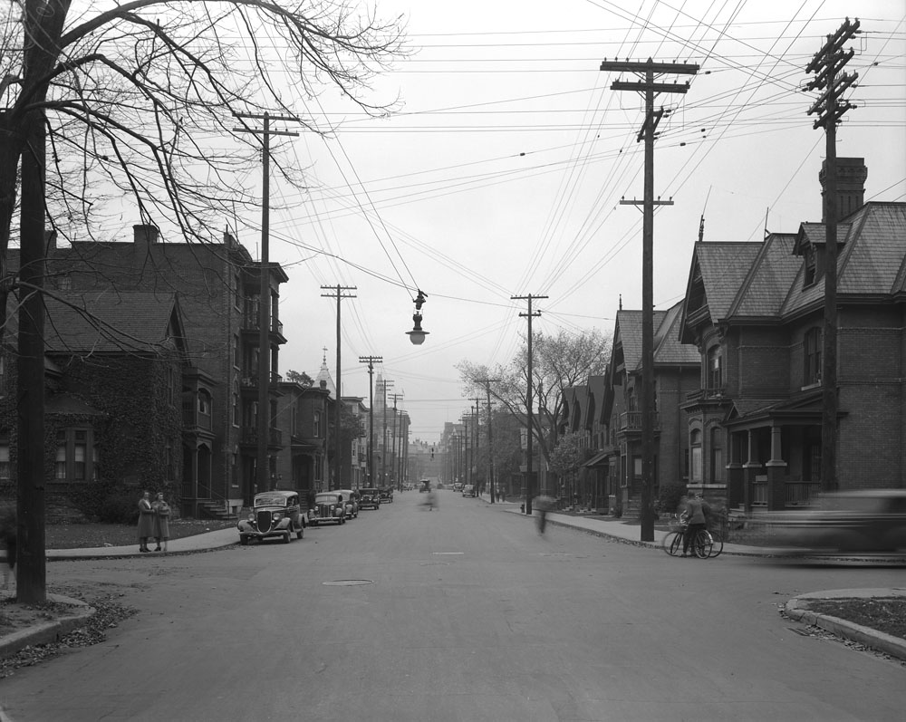
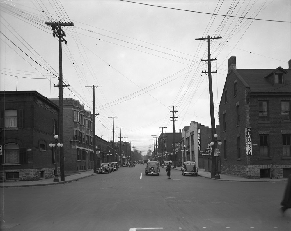
Follow the O’Connor of 1938 northward to past the intersection with Laurier, and you will note the predominance of low-rise residential structures, the front porches facing towards the sidewalk, the narrowness of the street, the unobtrusive light standards above intersections, the number of mature trees, and, the children playing in the middle of the street. (see images of the following O’Connor intersections: at Lisgar looking East [above] and North; at Gloucester looking West; at Laurier looking West and East; and Slater looking North.
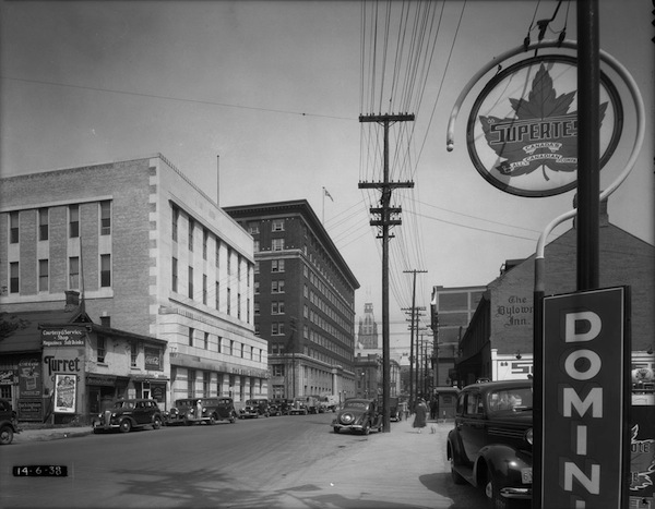
Not until the intersection of O’Connor and Albert (above) is there anything resembling a high rise. And this large “high rise” is the four storey Bell Telephone Building. Built in 1936, it is a magnificent Art Deco architectural creation. It was designed by Frederick John MacNab, chief architect of the Bell Telephone company from 1927 to 1953. It replaced two 19th century commercial buildings.
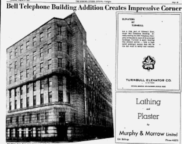
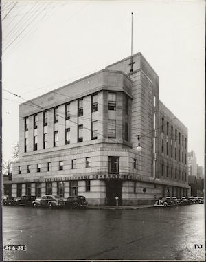 Our modern developers could learn a thing or two from studying the design of this building (see left image), which has a smooth exterior facade punctuated by a horizontal banding and numerous vertical windows at all levels, a main entrance that helps accentuate and define the building as a corner landmark, an aesthetically pleasing stepped approach to the O’Connor facade, and a geometrically angled corner facade that is set off by a five storey tower. In 1954 (see image below of ad in the Ottawa Citizen), an additional three floors were added. Note that the addition was sympathetic to the original design. Today, though still a massive complex, subsequent renovations have altered some of the original exterior features. The removal of the street level windows is the most glaring of changes. So an outward looking structure has turned in on itself.
Viewing these images of 1938 Centretown in relation to subsequent planning changes leads to the following questions. Are city planners still in the thrall of the Greber Plan? Is it time to rethink our approach to residential and streetscape design? In particular, is it time to rethink the way we envision what our streets are supposed to do? Is it time to move away from the one-way road corridor that supposedly moves cars quickly but little else? Next month, we’ll take a walk along Metcalfe Street and see how it has changed since 1938.


.gif)